


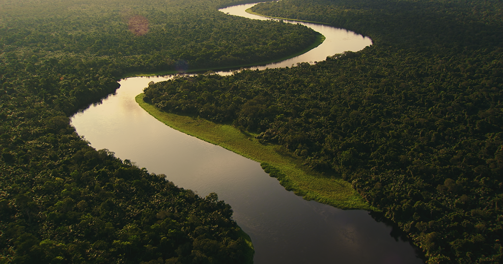
The Congo River is one of the world’s great freshwater systems, both in terms of hydrological power and navigational potential. It is Africa’s most powerful river, with the second highest discharge volume on Earth — after the Amazon — and is the deepest river globally, with measured depths exceeding 220 meters (720 feet).
This immense body of water plays a crucial role in climate regulation, freshwater supply, flood control, and inland transport, impacting both the Democratic Republic of the Congo (DRC) and the Republic of the Congo, as well as several neighboring countries in the basin.
💧 Hydrology: Power and Complexity
- Average discharge: ~41,000 m³/s at its mouth near Boma
- Maximum discharge: Can exceed 75,000 m³/s during peak rainy seasons
- Basin area: ~4 million km² (2nd largest in the world)
- Rainfall: Up to 2,000 mm annually in central basin zones
- Flood patterns: Dual rainy seasons create cyclical flood pulses, especially in the Cuvette Centrale (swamp region)
The Congo River flows year-round with relatively stable volumes, making it a critical resource in a region where seasonal rivers dominate. It feeds vast swamps, peatlands, and wetlands, many of which act as essential carbon sinks and biodiversity hotspots.
🛶 Navigation: A Lifeline in Central Africa
The Congo River is the main inland transport route in the DRC, a country with very limited paved roads. While rapids and falls limit full navigability, vast sections of the river and its tributaries are essential for moving people, goods, and resources.
Navigable Segments:
- Kisangani to Kinshasa/Brazzaville (~1,700 km): navigable by large boats and barges
- Kinshasa to Matadi: interrupted by Livingstone Falls and Inga Rapids (non-navigable stretch)
- Matadi to Atlantic Ocean: deep and navigable by ocean-going vessels
- Tributaries: The Ubangi, Kasai, Lulonga, Aruwimi, and Lomami rivers also offer extensive navigable waterways
⚠️ Limitations & Challenges
- Rapids: Major obstacles exist at Boyoma Falls (Kisangani) and Inga Rapids (below Kinshasa)
- Infrastructure: Old colonial-era ports and ferries need modernization
- Flooding: Unpredictable flood events can damage riverbanks and settlements
- Security: In some regions, insecurity limits safe river transport
- Climate change: Altering rainfall patterns and threatening water availability in the long term
⚡ Hydroelectric Potential
- The river holds enormous hydroelectric potential, particularly at Inga Falls, where the Inga I and II dams operate, and the planned Grand Inga Project could become the largest hydropower facility in the world.
- Hydropower is seen as both a development opportunity and an ecological risk, raising concerns about displacement, biodiversity loss, and disruption of sediment flow.
The Congo River’s hydrology and navigability have shaped the economies, ecologies, and histories of Central Africa. Today, they are central to debates on sustainable development, infrastructure investment, and climate resilience in the region.
